Here’s How Much Hotter Than Normal This June Has Been
Forecasters say it could be a multiyear period of exceptional warmth for the planet
Temperatures around the world this month have been at their highest levels in decades for this time of year.
The spike reflects two factors that are shaping what forecasters say could be a multiyear period of exceptional warmth for the planet: humans’ continued emissions of heat-trapping gases and the return, after three years, of the natural climate pattern known as El Niño.
Both factors are also setting the thermodynamic stage for more severe hot spells, droughts, wildfires and even hurricanes, which acquire their destructive energy from heat in the oceans.
“The short version is: Expect surprises,” Rick Spinrad, the administrator of the National Oceanic and Atmospheric Administration, said in an interview Monday. “We’re putting heat into the system — through climate change, through the greenhouse effect — and that heat is going to manifest. That energy is going to manifest in any number of different ways.”
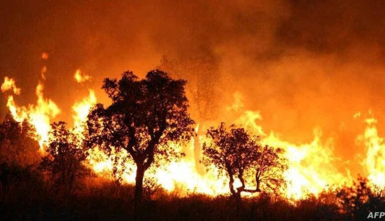
In recent weeks, it has manifested in Canada, where many areas are still dealing with huge forest fires that have churned toxic smoke into the United States. It has manifested in Siberia, which has been roasted by extreme heat, and around Antarctica, where the extent of the surrounding sea ice last month reached a record low for May.
El Niño conditions occur when the water at the surface of the central and eastern Pacific around the equator is warmer than usual. The intermittent phenomenon influences weather dynamics worldwide and tends to be associated with warmer years globally. But humans have pumped three additional years’ worth of greenhouse gases into the atmosphere since the last El Niño. That means the current one has emerged amid planetary conditions that could compound its warming effects.
This pile-on has also made it trickier for NOAA to forecast the 2023 Atlantic hurricane season, Spinrad said. El Niño tends to reduce hurricane activity by increasing wind shear, or the changes in wind speed and direction that can disrupt storms as they form. But the record warmth recently in parts of the North Atlantic could have an opposing effect by fueling stronger hurricanes.
NOAA last month said there was a 40% chance that this year’s hurricane season would be near normal. But it also assigned 30% probabilities to the season’s being above or below normal. “Where we may have had uncertainty in the past, we’re going to have larger uncertainty,” Spinrad said.
There’s another factor that could have made the world hotter recently, although it’s not clear how much. In January 2022, a volcanic eruption beneath the Pacific archipelago nation of Tonga blasted a huge amount of vaporized seawater into the atmosphere: at least 55 million tons, according to research published last year.
Like carbon dioxide, water vapor is a greenhouse gas: It traps heat near Earth’s surface. The plume from last year’s eruption may have increased the amount of water in the global stratosphere by more than 5%, the researchers said.
The weather’s natural variability is always causing swings, both warm and cool, between years and in specific regions. But human-driven warming remains the long-term trend, said Daniel L. Swain, a climate scientist at UCLA.
“We are still moving in a pretty alarming direction overall when it comes to warming,” Swain said. “There still hasn’t been a great deal of momentum away from that.” – New York Times


Comments are closed, but trackbacks and pingbacks are open.