

Satellite analysis identifies nearly 4,800 landslides after Ditwah
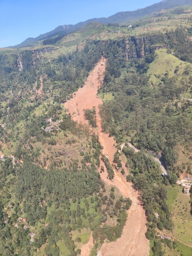
COLOMBO – Nearly 4,800 landslides have been identified across Sri Lanka through satellite-based assessments conducted in the aftermath of Cyclone Ditwah, according to Kumari Meegahakotuwa, Director General of the Arthur C. Clarke Institute for Modern Technologies.
Speaking at a media briefing at the Department of Government Information on Monday (12), Meegahakotuwa said the assessments were carried out using satellite imagery captured during and immediately after the cyclone, enabling a comprehensive nationwide mapping of landslide incidents.
She noted that the analysis revealed the actual scale of landslides is significantly higher than figures previously reported through media and ground-level assessments.
“Using satellite imagery obtained during and after Cyclone Ditwah, we conducted detailed landslide mapping across the country,” Meegahakotuwa said, explaining that based on the analysis, they were able to identify that the number of landslides was far greater than what has so far been reported. “Through satellite data, we have identified approximately 4,800 landslide incidents,” she pointed out.
According to the Arthur C. Clarke Institute, the nationwide satellite image analysis has allowed for the complete mapping of landslides, including in remote and inaccessible areas that may not yet have been reached by field teams.
Officials said the findings will support disaster response planning, risk assessments, and future mitigation and relocation strategies, particularly in landslide-prone regions affected by intense rainfall associated with Cyclone Ditwah.
-ENCL
Comments are closed, but trackbacks and pingbacks are open.